Arunachal: Workshop on NRIMAP using Remote sensing and GIS technologies held at Namsai
NAMSAI- A Workshop on Natural resources inventory for micro level agricultural planning (NRIMAP) using Remote sensing and GIS technologies organised by State Remote Sensing Application Centre in collaboration with Department of Agriculture, GoAP was conducted at DC’s Conference Hall Namsai. The meeting was chaired by Arunachal Pradesh State Council for Science and Technology, Chairman Bamang Mangha in presence of ADC, Namsai S. Mining and Dir. Science and Technology C. D Mungyak.
The chair gave a detailed overview and genesis of the project. He informed that the project had been taken up on pilot basis in 3 districts viz. Namsai, Lower Subansiri and Tawang which will further be introduced on a larger scale covering other districts based on the success rate of the pilot project. He highlighted that adoption of such projects will increase transparency ensuring funds from Govt. exchequer is not being misused.

ADC, Namsai in his address expressed gratitude to the visiting team for taking up the project at Namsai district. He sought cooperation from departments concerned in assisting the team for successfully rolling out the NRIMAP project. He assured that the base maps handed over by the chairman shall be revisited and authenticated to avoid any misrepresentation.
CEO, RSI, Hyderabad B.V Ramana Kumar gave a brief presentation on the activities being carried out by the institute.
‘RSI is the oldest scientific organisation in the field of Remote Sensing and GIS working under 700 projects across India’, he mentioned. He also gave an overview on NRIMAP and apprised that circle wise base maps have been prepared by the team which shall be handed over to Deputy Commissioner Namsai, for further authentication and necessary correction.
Detailed presentation showing natural resource mapping, base maps, contour map, transportation network etc. was given by Saumitra Deb, Scientist, SRSAC. Thereafter Scientist B. R Rao presented on soil mapping, soil profile study and emphasised that soil is an important parameter for cultivation of any crops. He informed that analysis of soil sample for availability of major and minor nutrients, soil classification and codifications etc. shall be carried out under the project.
It was also informed that a user friendly web application shall be developed for a highly initiative and effective recommendation system.
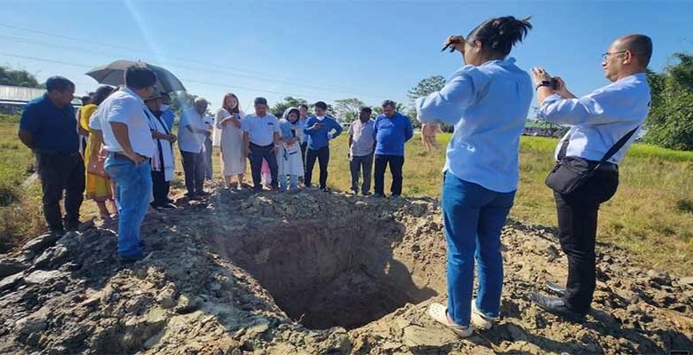
The session was following by a field visit at Kherbari, Namsai for soil profile study.
In attendance were HoDs and officials of department of Science and Technology, SRSAC, Agriculture, Horticulture, Fisheries and Forest.