

LAC: Line of Actual Control or McMahon Line; Explained
China had repeatedly protested the British drawings of boundaries.
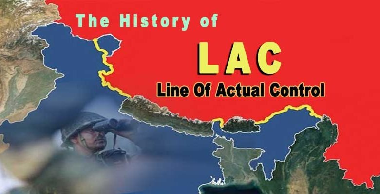
ITANAGAR- The Line of Actual Control (LAC), shared between India and China goes back to the British colonial era when the McMahon Line was drawn in 1914 between the borders of Tibet and India. China had repeatedly protested the British drawings of boundaries.
McMahon Line, frontier between Tibet and Assam in British India, negotiated between Tibet and Great Britain at the end of the Shimla Conference (October 1913–July 1914) and named for the chief British negotiator, Sir Henry McMahon.

In 1914, when India was under British rule, the Shimla Agreement was signed with the Government of Tibet. Sir Henry McMahon, an administrator of the British government, was the person to negotiate with the representative of the Tibetan government. In whose name the border between Tibet and India was named McMahon Line.
In this agreement, the border between the two countries was fixed by drawing a line on the map. After that the first map came on 27 April 1914 on which the representative of China signed. The second map came on July 3, 1914, on which China refused to sign. on the status and boundaries of Tibet on the ground that Tibet was subordinate to China and had not the power to make treaties.
In India, on the other hand, the map showing the McMahon Line was officially published in 1938 and has been valid ever since.
To the west of the McMahon Line is Bhutan, to the east is the Great Bend of the Brahmaputra River.
India believes that when the McMahon Line was drawn in 1914, Tibet was not ruled by China. Rather, Tibet was a weak but independent country, so it has every right to make a border settlement on behalf of its country. That’s why the McMahon Line is the clear demarcation line between India and China.
But China has never considered Tibet as an independent country, that’s why it does not even accept this McMahon line, which is the Line of Actual Control i.e. LAC. And this is the reason why China always keeps its eyes on Arunachal Pradesh especially Tawang. Even when Indian leaders come and go there, it shows anger.
The Chinese have claimed that Chinese territory extends southward to the base of the Himalayan foothills. This frontier controversy with independent India led to the Sino-Indian hostilities of October–November 1962. In that conflict the Chinese forces occupied Indian territory south of the McMahon Line but subsequently withdrew after a cease-fire had been achieved.