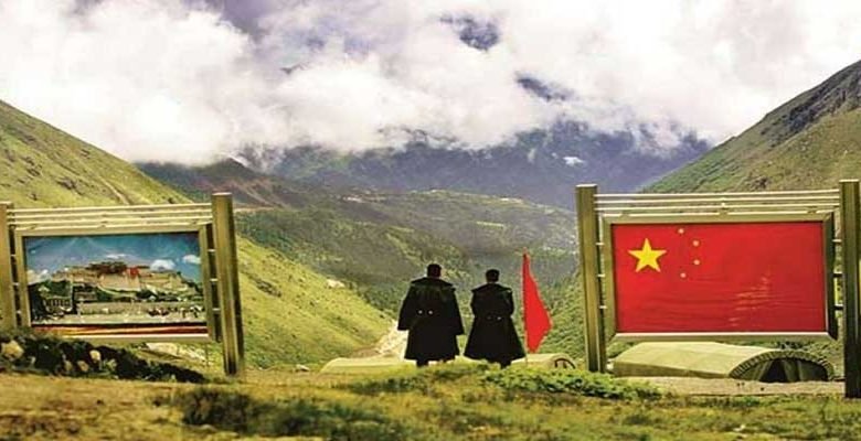
China renames 15 places in Arunachal Pradesh
The 15 new “standardised” names, along with their exact coordinates and a map, were released on Thursday by the Ministry of Civil Affairs.
- Arunachal Pradesh is shown on Chinese maps as “Zangnan” or “South Tibet”, and in 2017, Beijing issued six official names for places there
ITANAGAR- China has renamed 15 places in Arunachal Pradesh to buttress its claim on the Northeastern state of India. The 15 new “standardised” names, along with their exact coordinates and a map, were released on Thursday by the Ministry of Civil Affairs, days ahead of a new border law coming into force.
LATEST UPDATE-
@MEAIndia Official Spokesperson Arindam Bagchi Issues Response to a Media Query on … – Latest Tweet by Prasar Bharati News Services

“Arunachal Pradesh has always been, and will always be an integral part of India. Assigning invented names to places in Arunachal Pradesh does not alter this fact.”
"Arunachal Pradesh has always been, and will always be an integral part of India. Assigning invented names to places in Arunachal Pradesh does not alter this fact."@MEAIndia
— Prasar Bharati News Services & Digital Platform (@PBNS_India) December 30, 2021
China’s Ministry of Civil Affairs said on Thursday it had issued “standardised” names for 15 places in the Indian State of Arunachal Pradesh, to be used henceforth on official Chinese maps, part of broader recent moves by Beijing to step up its territorial claims.
Also Read- India has not accepted China’s illegal occupation or unjustified claims: Centre
Arunachal Pradesh is shown on Chinese maps as “Zangnan” or “South Tibet”, and in 2017, Beijing issued six official names for places there, which was at the time seen as a retaliatory move after the Tibetan spiritual leader, the Dalai Lama, visited the State.
The eight residential places in the second batch are Sêngkezong and Daglungzong in Cona County of Shannan Prefecture, Mani’gang, Duding and Migpain in Medog County of Nyingchi, Goling, Damba in Zayu County of Nyingchi, and Mejag in Lhunze County of Shannan Prefecture, the Global Times report said.
The four mountains are Wamo Ri, Dêu Ri, Lhünzhub Ri and Kunmingxingzê Feng, it said. The two rivers are Xenyogmo He and Dulain He, and the mountain pass is named Se La, in Cona County.
China claims Arunachal Pradesh as South Tibet which is firmly rejected by the External Affairs Ministry which says the state is an “inseparable part of India”.
Also Read- India ramps up Himalayan border security after clashes with China
Beijing routinely protests visits of top Indian leaders and officials to Arunachal Pradesh to reaffirm its claim. The India-China border dispute covers the 3,488 km long Line of Actual Control (LAC).